Are you going to another city or abroad? Then it is worth considering one point – traffic in roaming. It's too expensive even for fans Apple. If you're not at home, “surfing” can be ruinous. Telecom operators constantly issue invoices for hundreds of thousands of rubles.

You have to be careful with programs like maps. Many of them spend tens of megabytes of data. Before traveling, take care of analogs that do not need a network connection. We will help you make the right choice. Check out the best of its kind.
Google Maps
The map service Google is known to everyone. Build routes, navigate the terrain – with and without the world wide web. The project allows you to save the required regions to your phone.

Come – for example – to Paris before traveling. Then open the pop-up menu and click “Download Map”. The scale is also indicated there. Just remember that useful information will disappear (about traffic jams, public transport, etc.).
It is easy to find in App Store.
Yandex maps
Russian alternative Google Maps. It is believed to provide more detailed information in the CIS countries. In the rest of the world, the detail is worse. However, some things are subjective.
How to “untie” from the Internet? Through the menu, where there is a corresponding item. Use the “Map Download” – whole areas are available. After installation, everything is activated automatically (when the connection is lost).
Like? Forward to the store.
2 GIS
interesting 6.1-inch iPhone 12 and iPhone 12 Pro will go on sale first Apple will announce the launch of iPhone 12 from day to day
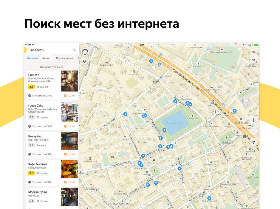
Why are Google Maps and Yandex Maps bad? Offline, they lose important functions. Only basic options remain. Want more? Look for the nearest access point. However, there is another way – 2GIS.

The default utility is bypassed without a connection. Online is only needed once – to download the desired city. Then 2GIS copes independently. The solution knows everything about the surrounding institutions. It helps with navigation, traffic patterns, finding restaurants, ordering a taxi, shopping center plans, and so on.
2GIS will always show you the way and tell you how long it will take. The detail is amazing. The software is free and weighs about 214 MB. Here is the link.
MAPS.ME
2GIS has a rival – MAPS.ME. The development of the service – quite successfully – is being handled by Mail.ru Group. The project is trusted by millions of tourists from all over the world. The program does not need the Internet. All data can be downloaded in advance.
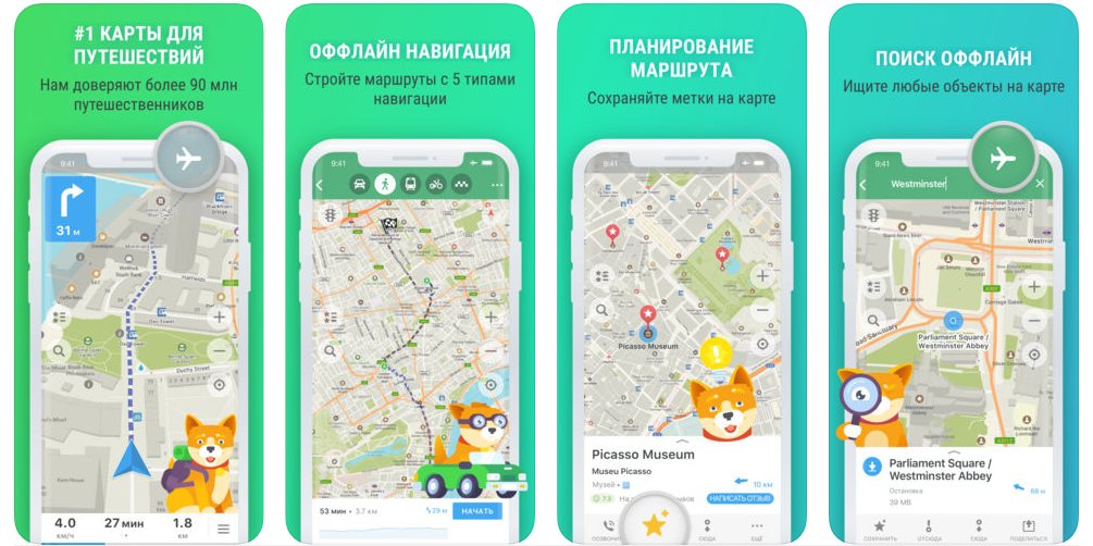
At the same time, MAPS.ME displays cafes, attractions, stops and custom labels. Each of the objects is provided with a “business card” (with a website address, phone number, reviews, etc.). GPS is used to determine the location.
Relevance is guaranteed by OpenStreetMap support. To start, you must have – at least – iOS 9. Where can I get MAPS.ME? Take a look at App Store.
CityMaps2Go
The developments listed above are the tip of the iceberg. There are no less famous analogues – not inferior in quality. CityMaps2Go is one of them. 20 million fans won't let you lie.
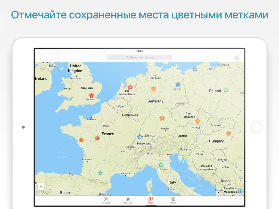
How is CityMaps2Go different from the competition? Photos of a great variety of places – with comprehensive help and comments. A real e-guide – with tips from experienced travelers.
Offline functionality – with preliminary preparation – does not suffer. The basic CityMaps2Go build doesn't require any money. Although the number of routes is limited to five.