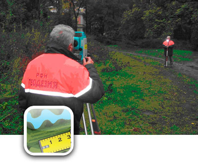
Distances and sizes of objects on a map can be very deceiving. The Map Measure app makes it easy to measure the distance between points or the area of a lot at iPhone. Of course, this program will not replace a full-fledged cadastre service, but it will give an idea of the size of the land plot, and will allow you to plan buildings.
Interface
At launch, we see familiar maps Google.
interesting 6.1-inch iPhone 12 and iPhone 12 Pro go on sale first Epic Games asks court to return Fortnite to App Store
In the settings, you can set the display mode:
- vector map,
- satellite imagery
- hybrid.
The main tools are hidden in the paperclip icon: through this menu, you can perform automatic determination of the current location, select the measurement mode – distance or area, view help.
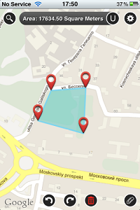
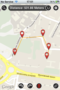
- A point is placed on the map with a long touch.
- Place turning points on the route you want or points that limit the area of interest.
- The line at the top will immediately display the measurement result: the length of the route or the area of the polygon.
The units of measurement can be selected by clicking on the letter U. The plotted route with the measurement result can be saved and, if necessary, loaded later. Measurement results can also be emailed as an image of a map area and a kml file that is compatible with the map service Google.
The application is quite useful for travelers and tourists, cartographers, surveyors. Map Measure is suitable for iPhone, iPod touch, and iPad, required iOS – 4.3 and higher, price – $ 0.99