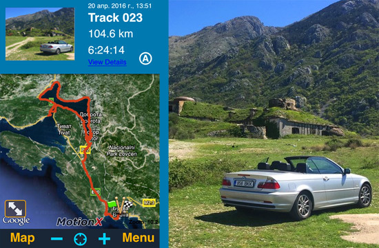
This application has been asked to buy one user of a shared account. My first attempt to understand the functionality of the program did not lead to success. After that, the application was transferred sequentially to two authors who wrote something like: another stupid map in Apstor. But a vacation was approaching, in which it was planned to travel a lot by car, and just in case, I installed Motion X on my smartphone. And for good reason, the application became my main navigator for two weeks. A huge functionality is hidden behind a terrible and incomprehensible design. But this is the first program for iPhone, for which I had to read the entire Help section as much as 37 pages. Now I can safely recommend Motion X to all travelers. These are maps, a navigator, a tracker, and much more … But all this needs to be reached through an unfriendly interface. I'll try to tell you how to do it …
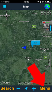
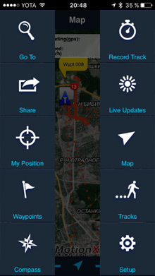
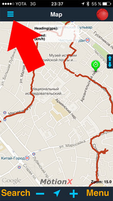
The main functions are available by clicking on the “Menu” button in the lower right corner of the screen. Next, I will describe the main features of this application for iPhone.
Object search and course plotting
The “Go To” menu item opens the search section.
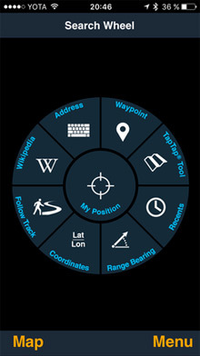
You can search for objects:
- Address – By typing the address in the search bar.
- Wikipedia – From the wikipedia database. A list of the nearest “points of interest” around you is displayed.
- Follow Track, Waypoint, Recents is a recall of previously recorded tracks and waypoints. How to set such points, see later in the article.
- Range Bearing – you can set the distance of the object from you and the angle in degrees. The application will draw a course to the object. Just like in the army.
- Coordinates – you can set the coordinates of the object with all possible numerical options (there are 6 of them). For example, DM is the classic degrees, minutes and seconds. Then you will receive the course.
- TapTap Tool – Just point your finger at the map and get the course.
It should be borne in mind that Motion X is not a navigator, and not maps like Yandex and Google. He will not route the roads. He will simply draw a straight line to a given point.
Track recording
Tracks are written “Menu” – “Record Track” – “Start”.
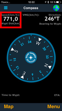
There are many different readouts here, including altitude and speed statistics.
From the experience of using this tracker and other similar ones, I can say that it is very reliable.
Launch the tracker, close the application, and the program silently records your entire movement. In this case, the phone does not heat up. Of course, battery consumption is growing, but not critical. The route will be recorded until you press Pause. Then the path can be saved with the Save button. You can record up to 300 tracks in total.
If these numbers are not enough for you, you can open an additional menu. Settings are hidden there. And you can also specify the operating mode, take a photo for the track and even control the player and flashlight.
In the same settings, it is possible to enable the recording of heart activity monitoring. Motion X supports ANT + technology. True, attempts to make friends with the application Apple Watch did not lead to anything. The following devices are listed:
Wahoo Fitness: ANT + and BLE,
Polar: ANT + and BLE,
Garmin: ANT +,
Timex: ANT +,
Adidas: ANT +.
interesting 6.1-inch iPhone 12 and iPhone 12 Pro will go on sale first FAS will start another check Apple
The horizontal track recording screen becomes more informative. From here there is an exit to large and beautiful traffic graphs.
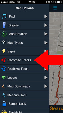
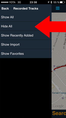
Tracks are recorded and stored on the device. By default, you can see all the recorded tracks that came before. To keep old routes out of the way, they can be removed from the screen. Click on the call list in the upper left corner. You can remove all the old tracks altogether, or make them blue.
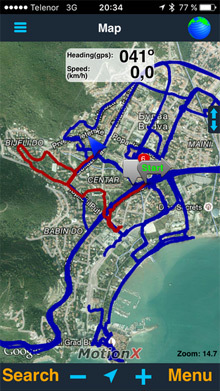
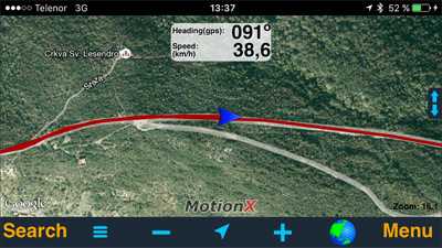
The recorded tracks are very helpful when you drive into an unfamiliar place. To get out, you just need to follow the red thread back. In this case, the map mode can be changed so that the location cursor is in the center of the screen, as in a conventional navigator.
Tracks are written even on the plane. If you want to know where the plane is located, open the map before flying. Zoom in, pieces of the map will remain in the cache iPhone and you will be able to see your location in flight even without the Internet. Altitude and speed are also displayed correctly, just place the device closer to the window.


Saving tracks
The recorded routes can be sent by mail, posted on facebook or twitter.
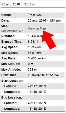
To do this, you need to set the settings in the Share section. I made it so that when you save a track, it is immediately sent to the mail. It is done like this: “Menu” – “Setup” – “Share” – enable One-Click Share at the very bottom. The letter contains all the statistical information along the way and a link to a route map, such as: gps.motionx.com/maps/ceb94c6f5d67bfbbb700edc59762664e.
This is the letter that comes to the mail when you save the track:
Map that opens by link:
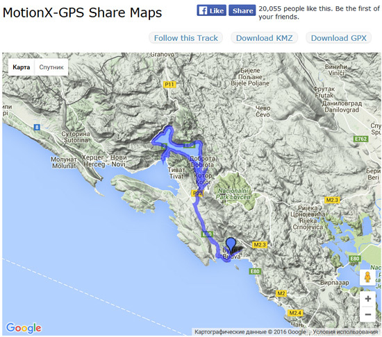
From there, you can save the track in the KMZ format.
In addition, you can turn on the Auto live updates mode and the location information will be sent automatically at a specified time interval (default 15 minutes)
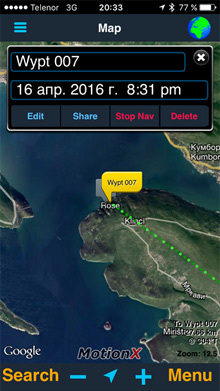
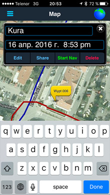
Placing Waypoints
For a long time I could not figure out how to do this until I tapped it twice on the screen. Well, you get the idea, yeah … Twice finger blooper. A blue cloud will appear, point it to the right place. Then click on the top of the inscription “Create” (in the status bar). Name the point and press the cross. Everything, the waypoint has been created. To delete, hold your finger on it, in the menu that appears, press Delete.
There are 14 types of maps available in Motion X from Bing Apple Google and MotionX.
In addition, it is possible to download offline versions of the maps, but only the own MotionX. For this, a 350 MB cache is allocated. By the way, the viewed maps are also cached.
For special perverts, there is the option to upload their own maps. Such an opportunity costs 370 rubles for an internal purchase. Then you need to get acquainted with the help on this topic.
http://basemap.nationalmap.gov/arcgis/rest/services/USGSTopo/MapServer/title
But I haven't mastered this yet. If anyone succeeds, write to me.